


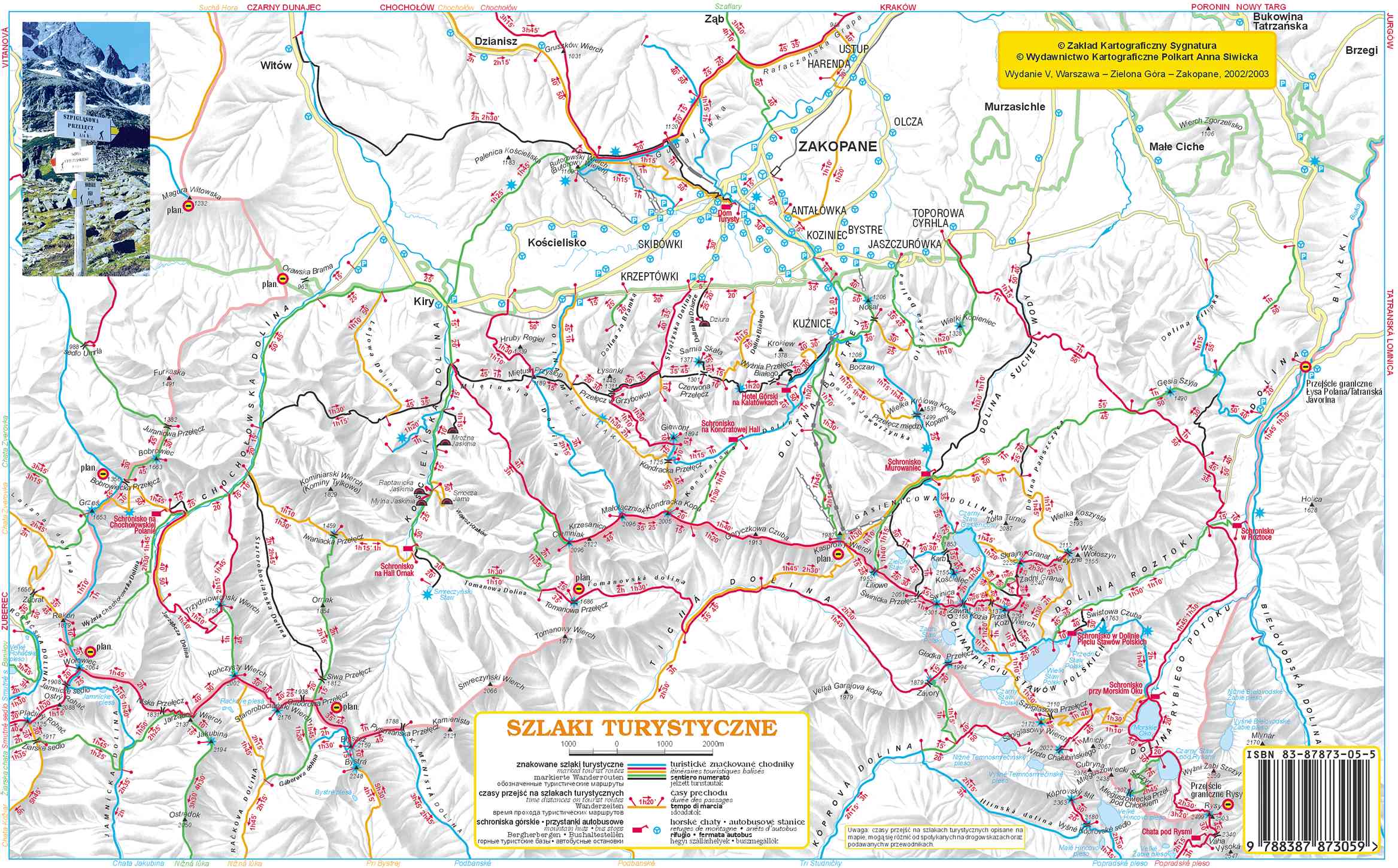
The most important thing when hiking is being prepared. And this includes a good map to help you find your way. In the Tatras (the Polish section at least) the hiking trails are all marked using a color (note: not colour) coded system. For blue trails go this way, for yellow go this way, etc. The colors do not, however, offer any information concerning the difficulty of the trail. We were unable to find a map that did too although I am sure they exist. Our simply showed a yellow hazard sign on the trail where there was danger. This could be a previous land slide area that was now safe, a trail that uses chains and requires climbing, or even a trail that consists of a sheer clif and requires a leap of faith. A wide range and not very helpful. We lost over an hour on one trail because the obstacle was too much for us and we had to turn back. 
Away from the signs trails are indicated by a painted mark. They are either painted on rocks or on trees as shown here. I have heard that in winter it is difficult to see the markers painted on rocks which often results in tourists becoming lost. 
An example of a trail that it might be good to know about BEFORE you attempt it is the one from Morskie Oko past Szpiglasowa Przełęcz to Dolina Pięciu Stawów Polskich. It only has three hazard signs but is it really difficult? I don't know. We were big wimps and didn't even attempt it! Next time... Can you see the trail on the picture? Can you see the people?
Here is another picture of that area. Can you see the people now?
For a basic idea of our map here is a similar map. Morskie Oko is in the bottom right corner near the ISBN barcode. The trail I am talking about is from Morskie Oko to the left. Its the yellow trail but the hazard signs are missing from this map. This photo was taken from Czarny Staw which is closer to the barcode. I will refer to this map in future posts so take a quick look now.
0 comments:
Post a Comment