


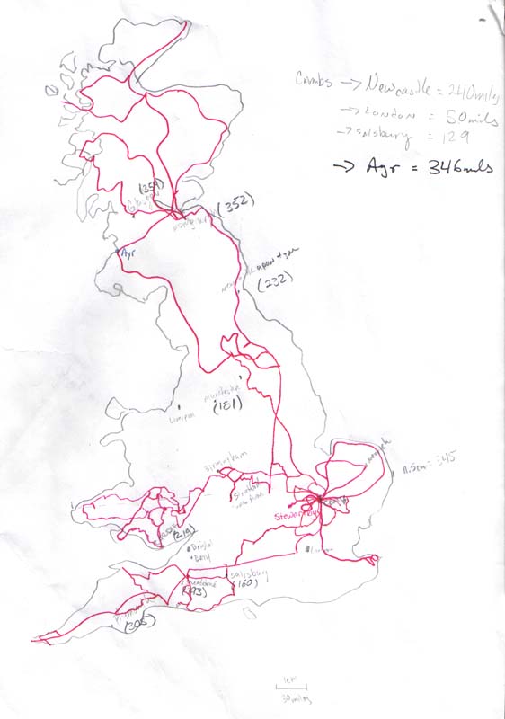
Here is the map I would keep at my desk and stare at while planning trips. The red lines indicate where I have been. The map itself is to scale but the roads are my best guess at the routes taken. I have a road atlas that I used with all the routes highlighted but this was a smaller, all of the UK on one page, version.
I was able to visit both Lands End and John O'Groats and have been all through East Anglia. I unfortunately missed northern Wales, the Lake District, Hadrian's wall, Dover, and loads of north west Scotland. Today my bike has 11250 miles bringing my summer total to 7350 miles! Not bad for just over three months of riding...
0 comments:
Post a Comment